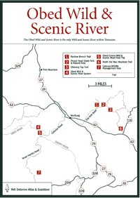
Wartburg rests at an elevation of 1,373 feet at the foot of Ward and Byrd
mountains on the Cumberland Plateau. According to the WPA Guide To Tennessee,
it was named for Wartburg, Germany. Carolyn Sakowski in Touring East Tennessee
Backroads says it was named for the castle in Thuringia, Germany, where
Martin Luther translated the Bible into German.
The colony was founded by George F. Gerding on more than 170,000 acres purchased with the intent of promoting German and Swiss colonization. Prospective colonists were met by agents of the East Tennessee Colonization Company in U.S. port cities or recruited in Germany and Switzerland.
In 1845, the first 50 settlers arrived from Germany. Many stayed at one of the first buildings in town, known as the Immigration House, until land could be cleared and dwellings built.
Between 1846 and 1855, more immigrants followed, most of German or Swiss nationality, and at one time the colony had hundreds of residents. There were several experienced artists and craftsmen in the community, including Frederic Beneike who established a piano factory and artist George Dury, a painter who arrived from Munich in 1849. He painted portraits of Robert E. Lee and Abraham Lincoln and his portrait of Mrs. James K. Polk hangs in the East Room of the White House. Yet despite some successes in wine-making, the poor soil and the isolation of Wartburg from main routes of travel led colonists to eventually begin seeking better lives in the larger cities of middle and eastern Tennessee.
By 1870, Wartburg had been established as the county seat of Morgan County. Today it is the gateway to Frozen Head State Park and Natural Area.