 The
Eastern Blue Ridge The
Eastern Blue Ridge
The
Eastern Blue Ridge The
Eastern Blue Ridge The Blue Ridge Mountains, which form the spine of the Eastern Blue Ridge, were formed more than 200 million years ago when the North American, European, and African continents collided—a process called "plate tectonics." The movement of two continents against each other produced an intense pressure from the direction of what is now southeastern Georgia. Over millions of years, the forces of nature have worn as much as 5 miles off the mountains, shaping them into the peaks, cliffsides, and valleys we see today.
The changes that have gone on for millions of centuries continue today. For example, the Eastern Continental Divide running through much of Georgia, separating the waters that flow into the Gulf of Mexico from those that flow into the Atlantic, is currently moving northward at the rate of 3,000 feet every million years. Rivers continue to change course. Until recently (in geological terms), the Chattooga River, which originates in North Carolina and flows along the border between Georgia and South Carolina, was part of the headwaters of the Chattahoochee River and flowed into the Gulf of Mexico.
 The
Savannah River, gradually cutting a path northward, eventually intersected with
the Chattooga and diverted its flow southeastward into the Savannah and eventually
into the Atlantic. This "river capture," one of the most interesting
and easily visualized phenomena of geological history, has occurred a number
of times in Georgia and is an ongoing process. Topsoil—the thin, fragile
covering of the hard gneiss and schist rock of the Blue Ridge—is forming
at the rate of about 1 inch every 50 to 100 years. Visitors to the foot of Toxaway
Dam can see how the flood of 1916 wiped away the topsoil down to bare rock in
a matter of minutes.
The
Savannah River, gradually cutting a path northward, eventually intersected with
the Chattooga and diverted its flow southeastward into the Savannah and eventually
into the Atlantic. This "river capture," one of the most interesting
and easily visualized phenomena of geological history, has occurred a number
of times in Georgia and is an ongoing process. Topsoil—the thin, fragile
covering of the hard gneiss and schist rock of the Blue Ridge—is forming
at the rate of about 1 inch every 50 to 100 years. Visitors to the foot of Toxaway
Dam can see how the flood of 1916 wiped away the topsoil down to bare rock in
a matter of minutes.
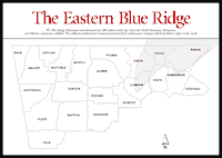
Georgia's Blue Ridge Mountains, with their rich geological history and diverse recreational opportunities, are surprisingly undiscovered. When visiting the mountains, most of us stick to the main highways; towns such as Helen, Clayton, and Dahlonega are familiar. But few people have discovered the upper portions of the wild and scenic Chattooga River, much less explored the hundreds of scenic logging roads, or, even less, walked the unmarked hiking trails known mostly to hunters and fishermen.
The information on the Eastern Blue Ridge in the following sections is designed to help readers get off the main roads and onto the back roads and trails and to discover the diversity, beauty, and surprising fragility of these ageless mountains.
Read and add comments about this page