 Traders
Hill Recreation Park
Traders
Hill Recreation Park Born in the Okefenokee and Pinhook swamps, the waters of the St. Marys River appear indecisive, flowing south, then east, then north, then finally east past the town of St. Marys to Cumberland Sound. The St. Marys River, a blackwater stream that drains 1,500 acres, winds 125 river miles to reach the sea only 50 miles from its birth. The main impediment is Trail Ridge, the Pleistocene dune line that helps create the Okefenokee Swamp and forces the St. Marys to make its tortuous journey south before reaching a gap and flowing to Cumberland Sound. The serene, beautiful river serves as the state line between Georgia and Florida, making the unmistakable "toe" in the southeastern portion of the state.
Mariners went out of their way to obtain the tea-colored water of the St. Marys, which was prized for its chemical qualities. Decaying vegetation produces tannic acid, giving the water its burgundy color and also acting as a preservative that would keep the water fresh for two years.
At the Okefenokee origin of the river, called the North Prong, the narrow river reflects images of stately moss-draped baldcypress, tupelo, and Ogeechee lime trees that line its banks. Trees in the channel become less prevalent as it moves away from the bog swamp, and the river picks up volume and becomes more winding after it meets the Middle Prong of the St. Marys, which has made the journey from Pinhook Swamp and Osceola National Forest. Swamp forests of water-tolerant species dominate the surrounding floodplain, which supports an abundance of palmettos and tropical species. White sand bars add to the beauty of the river and provide intimate camping spots.
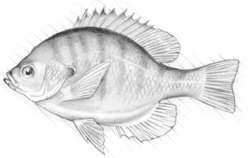
Quiet and observant paddlers may see swamp bears, deer, bobcats, raccoons, armadillos, opossums, and otters. Shy alligators, turtles, and snakes sun themselves before sliding into the dark, reddish waters. Frogs are more frequently heard than seen, singing their love songs in spring. Bird life is abundant, and vultures, osprey, hawks, and owls are year-round residents. Cruising above the water channels are kingfishers, as well as Mississippi and swallowtail kites, which are seen in spring. During migratory periods, songbirds flit across the river channel in front of the boat. Unsubstantiated reports of panther sightings are relatively common. Fishermen pursue the river's largemouth bass, crappie, redbreast, and bluegill.
Along the bottom of the toe, the South Prong joins the river and it turns toward Folkston. From the origin in the Okefenokee to St. George, the St. Marys River is a docile, narrow stream that is at its most wild and undisturbed character. As the canoeist approaches Traders Hill and Folkston, the river's banks rise to more than 7 feet, and the natural surroundings are increasingly disturbed by encroaching agriculture and powerboat traffic. Canoeists may want to explore some of the tributaries feeding the St. Marys, such as Spanish Creek a few miles north of Traders Hill. (Folkston once was the location of a Spanish mission, San Lorenzo de Ibihica, from 1620–1656.) East of Folkston, the canoeist starts to sense the influence of tides, and the river cuts deeper into its channel. Below US 17, the river's scenery becomes marsh and canoeists must contend with tides as they paddle to St Marys.
The river is appropriate for the novice, with the biggest dangers being deadfalls in the upper reaches and strong tides in the lower parts. There are many points of access for planning a variety of experiences, a short trip, overnighter, or weeklong trip. Camping is available on sand bars and high bluffs, but canoe-campers should get permission before camping on private property.
Suggested canoe trips on the St. Marys River: GA 94 (Moniac) to FL 120, 5.14 miles. FL 120 to GA 23, 12.4 miles. GA 23 to Stokes Bridge, 9.6 miles. Stokes Bridge to GA 94 (St. George), 13.7 miles. GA 94 (St. George) to Traders Hill Recreation Park, 27.5 miles. Traders Hill Recreation Park to White Springs Landing (Camp Pickney Park), 7.7 miles. White Springs Landing (Camp Pickney Park) to US 17, 26.3 miles. US 17 to St. Marys Waterfront Dock, 16.8 miles.
Traders
Hill Recreation Park [Fig. 23(9)] Once a fort and settlement, Traders Hill today is a 32-acre recreation park on the banks of the St. Marys River where visitors can launch a boat, camp, fish, swim, or enjoy the natural beauty of the river. It is close to the Okefenokee Swamp National Wildlife Refuge. When human activity is at a minimum, the park can be an excellent bird-watching site, with a variety of wading and woodland species seen in the waters and trees in the park.
First known as Fort Alert, an Indian trading post, it was renamed Traders Hill and was a thriving center of trade about 1755 and was designated the county seat when Charlton County was formed in 1854. The county seat was moved to Folkston in 1901.
Read and add comments about this page