Ah, the Eastern Shore of Virginiathe third part of the word Delmarva, which
refers to the peninsula that contains all of Delaware, as well as the Eastern
Shore of Maryland and Virginia. As the Delmarva Peninsula heads southward into
Virginia, it narrows into a fingerlike projection that separates the lower Chesapeake
Bay from the Atlantic Ocean.
The peninsula dwindles in size but expands, at least in some minds, in wild and remote beauty. For the Eastern Shore of Virginia is a holdout, a last outpost for a culture and a way of life barely known if known at all by many fellow Virginians across the bay. As the waters along the bayside tidal marshes grow saltier near the mouth of the Chesapeake, the people of southern Delmarva grow even hardier. From Chincoteague to Onancock to Wachapreague to Oyster to Cape Charles, the tough, seafaring watermen, the farmers, and their hard-working families have for many generations sustained themselves on the waters of the bay and ocean and the riches of the Eastern Shore soil.
Less than four decades have passed since mainland Virginians gained access to the peninsula via the 17.6-mile Chesapeake Bay Bridge-Tunnel at the southern end. Even since then, the distance from the mainland and the high toll (currently $10 for a one-way trip) necessary to pay for the engineering marvel has hindered any explosion in local traffic.
Marylanders on the western side of the bay gained access to the upper Eastern Shore in 1952 by way of the 4-mile Bay Bridge from Annapolis, but that access is some 110 miles away from the lower Eastern Shore. The lack of access has served as a barrier to commercialism and development, leaving this part of the Eastern Shore much less affected by the rapid changes that occurred when the upper shore was joined at the hip to Annapolis, Maryland.
It is possible to drive the 70 miles of US 13 from the bridge-tunnel up to the Maryland border in 1.25 hours. To appreciate the Eastern Shore of Virginia, however, the traveler should plan for a few hours, days, or longer to poke about the back roads. Rewards can be lasting for the person who sets aside a little time to explore Chincoteague and the Eastern Shore of Virginia national wildlife refuges, where red-backed sandpipers (Calidris alpina) probe the mud flats, or Assateague Island National Seashore, where wild ponies run free.
Theres a state park (Kiptopeke) that has a modern boat ramp and a fall birding festival. Two wildlife management areas (Saxis and Mockhorn Island) have huge flocks of snow geese (Chen caerulescens) and tundra swans (Cygnus columbianus) that fill the air with their winter chatter and willowy saltmarsh cordgrass that undulates in a summer breeze.
A good place to start if youre coming to Virginia from the north is the states New Church Welcome Center at 3420 Langford Highway (US 13) at the Maryland border north of New Church.
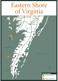
The NASA/Wallops Visitor Center [Fig. 7(14)] (757-824-1344) is on VA 175 between US 13 and Chincoteague Island. The center has exhibits on the United States space flight program and (by advance reservation) tours of the spacecraft launch sites. Tourists at Chincoteague are thrilled when a launch happens to go with a roar and trail of fire while theyre watching.
At Oak Hall, on US 13, four miles south of the Maryland border, is The Decoy Factory (757-824-5621), the worlds largest of its kind. Artisans carve and paint wooden ducks, geese, and other waterfowl native to the Eastern Shore as visitors watch. Decoys and other gifts are available for purchase.
Several picturesque waterfront towns are off US 13 on one side or the other. Onancock, in Accomack County on the bayside of US 13, was founded in 1680 as Port Scarburgh. Travelers can stop here for groceries, dry goods, and locally made crafts at Hopkins and Brothers Store, one of the oldest general stores on the East Coast. Owned and maintained by the Association for the Preservation of Virginia Antiquities, the store has been named both a Virginia and U.S. historic landmark.
Onancock also has a newly renovated wharf beside its deep-water harbor. Cruises to Tangier Island in the Chesapeake Bay begin and end on Onancock Creek. The Eastern Shore of Virginia Historical Society (757-787-8012) is housed at Onancock in the Kerr Place, an impressive Federal-style manor house built in 1799. The structure is a Virginia Historic Landmark and is on the National Register of Historic Places.
Known for the outstanding flounder fishery in the nearby creek mouths and tidal guts, Wachapreague is a popular fishing port on the ocean side of the peninsula. It is located at the eastern end of VA 180 off US 13, about 6 miles north of the Accomack County border.Many charter boat captains here and out of seaside harbors at Chincoteague, Quinby, and Oyster specialize in offshore deep-sea fishing for marlin and tuna, and fishing over sunken wrecks for tautog and sea bass. Spot, croaker, bluefish, rockfish, speckled trout, cobia, and big red and black drum can be caught closer to shore or from piers or surf on both sides of the peninsula. See Outfitters, Guides and Suppliers for charter and headboat information.In fact, the peninsula is brimming with marinas, boat landings, charter boats, and bait shops to supply the angler with everything he needs. Despite its lack of commercialism, the Eastern Shore of Virginia also has a surprising number of motels, affordable bed and breakfast inns, campgrounds, and outstanding seafood restaurants. Cooks from little towns like Cheriton and Temperanceville have been preparing fritters, crab cakes, soft-shell crabs, and fried oysters since they were big enough to flip a fillet.The entire town of Cape Charles is on the National Register of Historic Places because of its Historic District. Cape Charles has what is probably the largest concentration of late-Victorian and turn-of-the-century buildings on the East Coast. The town is located at the western end of VA 184 near the southern end of the Eastern Shore.
Charter boat operators of this bayside port city are busy spring through fall taking anglers to such popular fishing spots as The Cell and the rock islands of the Chesapeake Bay Bridge-Tunnel. The Cape Charles Museum and Welcome Center (757-331-1008) is also here, in addition to several restaurants and shops. The annual Between-the-Waters Bicycle Tour is run out of Cape Charles in October.
Campgrounds are at Chincoteague, Quinby, and Cheriton. Inlet View Waterfront Campground (757-336-5126) at Chincoteague has a restaurant, camp store, boat ramp, fishing pier, go-cart track, and pony rides. Maddox Family Campground (757-336-3111 or 757-336-6648) at Chincoteague has a playground and gift shop. Virginia Landing (757-336-5126) at Quinby has a camp store, boat ramp, fishing pier, marina, and ball fields. Cherrystone Family Camping Resort (757-331-3063) at Cheriton is open year-round. It has a restaurant, boat rentals, fishing piers, boat ramp, bait shop, and mini-golf.
Read and add comments about this page