| |
Wildlife Viewing Guide |
 Presidential Pathways
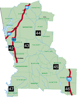
 After leaving Atlanta, the Chattahoochee River travels through this area and then crosses the Fall Line just south of West Point, where it becomes the border with adjoining Alabama. This land is part of the Apalachicola watershed, which includes the Chattahoochee River and the Flint River. The Flint River is a very special place with spectacular natural features like Sprewell Bluff, Dripping Rock, and Yellow Jacket shoals; tributaries like Potato Creek with its spider lilies and Big Lazer Creek; and the many other streams that spill through deep ravines. The ravine forests here contain a rich mix of mountain, coastal plain and piedmont plant and animal species. Pine Mountain, the southernmost mountain in the State, provides a surprising opportunity for scenic vistas otherwise available only in extreme north Georgia. Located on the east end of the mountain, Warm Springs was the favored home of President Franklin Delano Roosevelt, who found relief from his polio pain in these natural waters. The home of President Jimmy Carter is also located on the south end of the area in the town of Plains.
Read and add comments about this page