 Lake
Conasauga Recreation Area
Lake
Conasauga Recreation Area Seventeen-acre Lake Conasauga [Fig. 14(17)], located at 3,150 feet, near the summit of Grassy Mountain, is the highest lake in Georgia. The name "Conasauga" is derived from the Cherokee word kahnasagah, meaning "grass," "sparkling water," or "strong horse," according to various sources. Grassy Mountain, at 3,682 feet, is one of the higher mountains in the area, and the grassy Ball Field is nearby.
Conasauga River and Lake Conasauga do indeed sparkle. The river has been compared to a strong horse because it overflowed its banks and flooded after heavy rain. Whatever the source of the name, a river, lake, and several Indian settlements in the area are called "Conasauga."
Lake Conasauga, the picnic area, and U.S. Forest Service roads 17, 18, and 68 were constructed by the Civilian Conservation Corps during the administration of Franklin D. Roosevelt.
A fully developed Forest Service campground is available. The 35 campsites have tent pads. Restrooms and cold running water are centrally located. Most of the sites are not on the lake, but are very close. This is a heavily used campground, and on busy summer weekends it is likely to be full. There is an overflow camping area. No water is available but there are portable toilets. The group camping area is a large grassy field without tables, grills, or water.
The entire recreation area is accessible from the day-use area, which has a restroom, water, tables, grills, two covered shelters, and a parking lot. The large, heavily used but rarely full picnic area offers quiet solitude a short walk from the car. Food and equipment must be carried to the picnic tables and shelters that are some distance from the parking area. At the lake there is a developed swimming area with a pea-gravel bottom and a dock. There is no beach for sunbathing, but a pleasant, grassy ledge instead. Swimming is restricted to the marked swimming area. The water remains cool most of the summer, though by July 4 it is quite comfortable.
Off the picnic road is a boat ramp and parking lot access road. The lake is limited to electric motors, rowing, and paddling. It is a great place to canoe or raft.
Although the lake is heavily fished, some very large bass live in the deeps. Rainbow trout are stocked, and good populations of bream are also present.
Lake
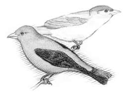
Conasauga Recreation Area [Fig. 14(17)] This is a Song Bird Management Area, where the trees and other vegetation are managed to provide the best bird habitat. Over 100 species of birds have been seen. These include hawks, owls, woodpeckers, kinglets, thrushes, vireos, warblers, cuckoos, phoebes, flycatchers, chickadees, titmice, nuthatches, brown creepers, wrens, tanagers, grosbeaks, indigo buntings, and red crossbills. A checklist of the birds is available from the Cohutta Ranger District Office.
Like most of Georgia's highlands, the elevation, climate, vegetation, and nesting birds of Lake Conasauga are similar to those in Pennsylvania. Georgia's mountains are the approximate southern limit for Eastern hemlock and Eastern white pine. This is an excellent area in which to see a wide range of trees, shrubs, herbs, and flowers representative of the southern highlands, including the yellow and black birch and mountain camellias. A plant list is also available from the ranger district office.
LAKE CONASAUGA TRAIL. 1.2-mile loop. An easy walk around the lake, passing through tunnels of rhododendron and crossing picturesque bridges. Interesting ferns, wildflowers, shrubs, trees, birds, and scenic views of the lake are found along the trail.
GRASSY MOUNTAIN TOWER TRAIL. 2 miles. From the dam on Lake Conasauga to the old fire tower atop Grassy Mountain, this trail makes an easy ascent along the ridge. To the west are excellent views of the wilderness and valley.
SONGBIRD TRAIL. 1.7-mile loop. This trail begins at the overflow, then runs along a small brook and around a beaver swamp through the Songbird Management Area, a series of clear-cuts which provide a variety of vegetation valuable to many songbirds.
Interpretive signs explaining songbird habitats lead hikers around the trail. Nature walks are offered on certain weekends between Memorial Day and Labor Day.
[Fig. 14] The Conasauga River is born deep in the Cohutta Wilderness. From its inception, it flows north through a series of rapids through almost inaccessible steep gorges before reaching the Alaculsy Valley. Here it appears to rest for a couple of miles before its confluence with the Jacks River. This upper section offers beautiful scenery and rough-country hiking.
Considered uncanoeable by most, at very high water levels the upper section provides a few hardy souls a wild-water experience hard to beat. The section beginning where the Conasauga leaves the valley at its confluence with the Jacks is more suited to recreational paddling. Here the river turns westward to cut across several ridges before bending south to join the Coosawattee and eventually become part of the Coosa River system.
This is a crystal-clear mountain stream which during the summer lacks sufficient water for easy navigation by canoe. On the section below the Jacks River confluence, most of the rapids are intricate Class I or Class II mazes—excellent water to help sharpen water-reading skills. There is one Class III rapid thrown into the middle of the run to keep paddlers alert on this exceptionally scenic river.
The Conasauga is normally high enough to run during the winter and spring months. Even at these higher levels it will remain clear. Since this river rises rapidly in times of flooding, avoid putting in if it is cloudy and turbid. There are no specific hazards for intermediate or advanced canoeists, although the one Class III rapid could cause problems for less-experienced paddlers. Cold-weather paddling trips are for experienced groups only. Full wet-suit protection and complete safety and first-aid gear are essential.
Read and add comments about this page