 The
Bartram Trail The
Bartram Trail
The
Bartram Trail The
Bartram Trail William Bartram was a native Philadelphian from a prominent family boasting kinship with Benjamin Franklin. In his early 30s, Bartram first traveled with his father, John Bartram, in Florida and coastal Georgia, becoming enamored with the southern wilderness—a fascination which was to launch him on a career that would lead to worldwide fame. An instinctive naturalist and explorer, he roamed through Georgia, North Carolina, South Carolina, Florida, Alabama, Mississippi, and Louisiana from 1773 until 1778, studying and drawing the plants and animals of the region and collecting plant specimens for his livelihood. His voluminous illustrated journals of those trips serve as the basis for the Bartram Trail, a portion of which now winds through the north Georgia mountains.
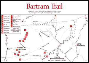
The north Georgia portion of the Bartram Trail begins about 1 mile east of Commissioner's Rock on the Georgia/North Carolina line, where it crosses NC 106 at the Osage Mountain overlook. It heads southwest for approximately 3 miles across the headwaters of Holcomb Creek. It then joins an old jeep road at Beegum Gap and follows it up a ridge 2 miles to Rabun Bald—Georgia's second highest mountain at 4,696 feet. At Rabun Bald, an old, abandoned Forest Service fire tower was converted by the Youth Conservation Corps into an observation deck, utilizing a natural rock base built by the Civilian Conservation Corps in the 1930s. The trail goes southwest for about 7 miles, following the Tennessee Valley Divide, and provides several beautiful vistas of the surrounding Blue Ridge Mountains. At Courthouse Gap, the trail turns southeast and follows Finney Creek and Martin Creek for about 3 miles; a turn back to the west here takes the trail to the crossing of Warwoman Road and into Warwoman Dell Picnic Area. From Warwoman Dell [Fig. 57(15)], it winds in a general easterly direction until it reaches Sandy Ford Road, where the trail turns north along the Chattooga River.
Another section is the portion that continues from Warwoman Creek to the confluence of the West Fork of the Chattooga River with the Chattooga River. In the future, a suspension bridge will carry the trail across the West Fork, where it will continue up the Chattooga to the GA 28 bridge and across into South Carolina.
Although there are extremely large white pines and hemlocks where the trail passes through Warwoman Dell, the vegetation of the Bartram Trail is not spectacular. It does, however, expose hikers to a representative cross section of north Georgia plant life. Changes in elevation, with a steady drop from Rabun Bald to Warwoman Road, and somewhat abrupt directional changes from shady north-facing slopes to sunny west and south exposures, provide habitat for many distinct plant communities. Sourwood, sugar maple, red maple, sweet birch, hemlock, white pine, pitch pine, Fraser magnolia (discovered by Bartram), and a variety of oaks and hickories make up the second-growth tree population. Spicebush, sweetshrub, dog-hobble, and blueberries inhabit the shrub level. The trail cuts through large colonies of galax growing under massive mountain laurel and rosebay rhododendron thickets. On the north-facing slopes and near the small streams and springs that cross the trail, grow numerous fern species, including Christmas, northern maidenhair, royal, cinnamon, interrupted, marginal shield wood, lady, and New York fern. Running ground pine, a club moss, grows in abundance in some areas. Typical wildflowers include Vasey's and Catesby's trilliums, trailing arbutus, partridge-berry, rattlesnake plantain, and wild ginger.
For additional information on the Bartram Trail, see the North Carolina Bartram Trail listing in Appendix F.
Read and add comments about this page