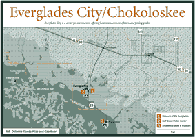
[Fig.
15, Fig.
17] Access to the western side of Everglades National Park
is strictly by water. The Gulf Coast Visitor Center located between Everglades
City and Chokoloskee provides information on ways to safely enjoy and experience
the Ten Thousand Islands and the mangrove wilderness of the Everglades National
Park backcountry. In addition to an information booth, interpretative displays
and a short video detail the way in which the natural system operates.
Two-hour boat tours of a portion of the Ten Thousand Islands operate daily out of the visitor center. An on-board naturalist will explain the natural history of the area, including the role of the mangrove, and will point out the wildlife that comes into view. It's common to see a wide variety of the area's birds, including roseate spoonbills, white and brown pelicans, osprey, laughing gulls, and royal terns. Manatees are sighted on about 80 percent of the trips. If you want a close look at black skimmers, they can usually be seen standing in large numbers on the dock at the visitor center between their morning and evening feeding times.
Forty-six primitive campsites are available throughout the backcountry for boaters and paddlers wishing to extend their stay in the wilderness. Sites include ancient shell mounds, old home sites, beaches, and chickees, which are open, 10- by 12-foot elevated platforms constructed for camping in the mangrove estuary. Each chickee has a chemical toilet and a shelter with a roof. A free-standing tent is best suited for use on the chickees because stakes and nails are not permitted. Permits, charts, and backcountry planners are required and will only be issued 24 hours in advance.
Canoes can be rented at the visitor center and in Chokoloskee and Everglades
City. Kayaks and power boats can be rented in Chokoloskee and Everglades City.
Two canoe trails that end near the visitor center offer easy, half-day or full-day trips to experience a part of the mangrove backcountry and the Ten Thousand Islands. On any canoe outing it's important to wear a long-sleeved shirt, and carry insect repellent, water, and a map.
Before starting out always check the conditions report at the visitor center for the chances of rain, tide times, and wind forecasts. Windy conditions in the wide bays have swamped many canoes. A falling tide flows away from the mainland and a rising tide flows inland. In the summer, afternoon thunderstorms can pop up without warning and bring strong, sudden winds. NOAA Chart 11430—Lostman's River to Wiggins Pass—covers the local waters.
Canoe outfitters in Everglades City will arrange for pick-ups and drop-offs.
For more information: Everglades National Park Headquarters, PO Box 279, Homestead, FL 33030. Phone (305) 242-7700. For information on canoe rentals contact Everglades National Park Boat Tours, PO Box 119, Everglades City, FL 33929. Phone (941) 695-2591.
Turner River Canoe Trail
[Fig. 16(3)] This 8-mile trail begins at a launch site on US 41, 0.5 mile west of the H. P. Williams Roadside Park, and ends in Chokoloskee Bay at either Chokoloskee Island or the Everglades National Park Gulf Coast Visitor Center. It passes through a grassy prairie, past cypress trees, and into the mangrove forest. The Turner River enters Chokoloskee Bay opposite Chokoloskee Island. Arranging to end your trip at the National Park Service ramp next to Outdoor Resorts on Chokoloskee Bay will save you paddling 3 miles of open water to the visitor center in Everglades City.
Halfway Creek Canoe Trail
[Fig. 16(4)] This 6-mile trip launches on Seagrape Drive, which turns off of US 41. Paddlers follow the creek through mangrove-lined channels then south past Plantation Island to Chokoloskee or the Gulf Coast Visitor Center. Take-out points are along the causeway between Everglades City and Chokoloskee Island or at the visitor center in Everglades City.
Directions: The Halfway Creek Canoe Trail begins at a boat launch located 0.7 mile down Seagrape Drive. From US 41, Seagrape Drive is 2.2 miles east of SR 29.
Trail: 6 miles one-way. The trail takes 5 to 6 hours to canoe depending on tides and wind.
[Fig. 16(6)] The Wilderness Waterway is a 99-mile-long marked powerboat and paddle trail that traverses the backcountry of Everglades National Park between Everglades City and Flamingo. The trip, which takes at least one day by powerboat and eight days by canoe, should not be attempted without careful planning and a full understanding of how to use navigation charts and the conditions expected in the Everglades backcountry. Shorter loop trips can be made from either end of the route.
Regardless of the length of trip you plan, ask for a backcountry trip planner and purchase navigation charts from area bait and marine supply stores. You can also order charts from the Florida National Parks and Monuments Association, 10 Parachute Key #51, Homestead, FL 33034-6735, (305) 247-1216, www.nps.gov/ever/fnpma.htm. The planner contains safety information such as how to file a float plan, recommended navigation charts, descriptions of the various sites, necessary equipment, and park regulations. The chart is a standard navigation chart for these waters, but the various campsites and the Wilderness Waterway are marked. The entire trip requires NOAA Chart 11433 Whitewater Bay, NOAA Chart 11432 Shark River to Lostman's River, and NOAA Chart 11430 Lostman's River to Wiggins Pass.
Mangrove waterways have a tendency to look very much alike. It's easy to get lost if you haven't taken the proper precautions. Review your route with rangers before starting out. Take binoculars so you can see distant channel markers, and carry a compass. In the summer be prepared for thunderstorms and high numbers of insects.
Boats more than 18 feet (5.5 meters) long or with high cabins or windshields should not attempt the trip because of narrow channels and overhanging vegetation.
A backcountry permit is required to use any of the backcountry campsites. A fee is charged and permits are available only 24 hours in advance from the Gulf Coast Visitor Center in Everglades City or the Flamingo Visitor Center in Flamingo. During winter, windy cold fronts can slow your progress and campsites fill up fast.
The mangrove wilderness has a remarkable amount of human history for such an out-of-the-way place. Campsites are on chickees, isolated beaches, Indian shell mounds, and old homesites. Almost every spot has a bit of history attached to it. An invaluable resource as a guide and a source of history attached to many of the campsites is A Guide to the Wilderness Waterway of the Everglades National Park by William G. Truesdell. Additional charts, written guides, and historical background books may be purchased at visitor centers or ordered from the Florida National Parks and Monuments Association, 10 Parachute Key, Suite 51, Homestead, FL 33034-6735. Phone (305) 247-1216.
[Fig. 16(5)] Located 17 miles south of Chokoloskee Island on the Chatham River is a campsite called the Watson Place. It sits on the site where the notorious Ed Watson had his home and operated his farm prior to his demise in 1910 at the hands of the people of Chokoloskee.
The site can be reached by power boat in little more than an hour and by experienced canoeists in a full day. The Watson Place is a good destination for a partial trip down the Wilderness Waterway and into the backcountry.
Begin your trip in either Everglades City or Chokoloskee Island and follow the Wilderness Waterway south. The route goes up the Lopez River, then along Crooked Creek. The Lopez River is named for a Spanish family that homesteaded along the river in the late 1800s and lived here for two generations.
From here the Wilderness Waterway crosses Sunday Bay, the first of a series of shallow inland bays along the Wilderness Waterway. Then travel on through Oyster Bay, and into Huston Bay as far as Marker 105. The bays can become very choppy under windy conditions. Paddling across them can sometimes be a challenge. Be sure to have the next channel marker in sight before leaving the last one completely behind.
At marker 105 the route to Watson's Place turns southwest away from the Wilderness Waterway and down a branch of the Chatham River that connects to the main river channel. A small dock and chemical toilet mark the site of the Watson Place, as does a huge royal poinciana tree (Delonix regia) that blooms bright pink in the spring. The same tree is plainly visible in a 75-year-old photo of the Watson farm.
Like much of the dry land in the park's backwaters, the Watson Place campsite is mostly a shell mound left by the Calusa Indians. These early Floridians were fishing and gathering shellfish from the Chatham nearly 2,000 years ago. Although gone by the eighteenth century, they left behind this 40acre shell mound as evidence of their long habitation.
Sometime after the Calusa were gone, Seminole Indians were the first to make use of the high ground for cultivation. Seminole crops of potatoes and sugarcane were last reported at the site in 1856, during the Third Seminole War.
In 1892 Ed Watson purchased the site and ran a profitable vegetable farming and syrup making operation for 18 years.
The campsite is located near where Watson's twostory farmhouse once stood and where he made syrup. All that remains today are two large cisterns, a few rusty pieces of machinery, and some outofplace vegetation.
In the summer, swallow-tailed kites can sometimes be seen tilting back and forth in the air just above the mangrove treetops. West Indian manatees also frequent these tannin-stained waters, but the animals can only be seen when they rise to take a breath.
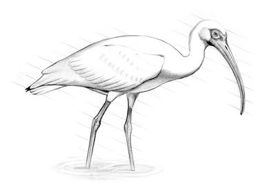
The mangroves in this part of the park are very well developed, standing 50 or 60 feet above the water. It's common to see osprey or even a flock of white ibis perched in the high branches. At night you may hear the screaming of raccoons fighting somewhere deep in the forest.
When camping at Watson's or at any of the backcountry sites take extraordinary precautions against raccoons. They'll look through your boat and through everything you might leave outside. They can open any cooler, bait bucket, or live well; and they will.
The Chatham River winds about five miles through the mangrove forest. A tidal river, it carries freshwater runoff from the Everglades to the Gulf of Mexico, and carries salt water inland to the highly productive brackishwater mixing zones.
About 1 mile upstream from Watson's, the river branches into a number of smaller streams that connect to different inland bays. Downstream from Watson's, the Chatham remains much the same for about a mile. Then it begins widening gradually and becomes shallower. Oyster bars dominate the last mile of the river.
The river usually holds a good population of seatrout and snook, especially in the winter. Try drifting a live shrimp, or use any type of plastic grub sold at the local tackle store in Chokoloskee. Casting plugs next to the mangroves is an explosive way to fish if you happen upon a big snook or tarpon. Topwater plugs that run shallow or on the surface and have a lot of action, like a broken-back Rapala or Zara Spook, attract a whole range of backcountry sport fish.
Bottle-nosed dolphins can often be seen in these waters, and if you're in a power boat, don't be surprised to see one come over and play in the bow wave if you go slow enough.
The mouth of the Chatham is probably the most popular place to fish on the river, although it can be difficult to navigate because of an abundance of oyster bars. During high tide, both redfish and snook feed over these oyster bars. Plastic jigs are a good choice for redfish but can be difficult to use in shallow water. A silver or gold spoon is an excellent substitute. They should be fished slow, barely fast enough to make them wobble and stay off the bottom.